Digital twins · 360° AI vision · Integration

Spatial intelligence for
real‑world sites.

From construction to daily operations, Panoptec gives security, safety and facilities teams one live 3D view of the site, powered by 360° AI cameras and the systems you already run.

How it works

Four layers, built on one model

Each layer adds to the one below it. Start with the base model and add live data as your site is ready.

L1 · Base model

A measured digital twin

An accurate 3D model of your site, built with AI from satellite imagery, scans and existing floor plans. Tenancies, levels and circulation space are mapped.

L2 · Precinct

The site in context

Car parks, entries, loading docks and the surrounding streets joined to the building model, so you can plan across the whole precinct.

L3 · Live vision

Live video, in 3D

Live video placed into the model where it is filmed. 360° AI cameras cover a full circle from one mount, and their streams are mapped onto the 3D model so operators look around the site instead of across a wall of screens.

L4 · Operations

One view for the control room

Events from access control, IoT sensors and video shown where they happen in the model, so operators respond to a location instead of a list of alerts.

Where we come in

Solutions

6
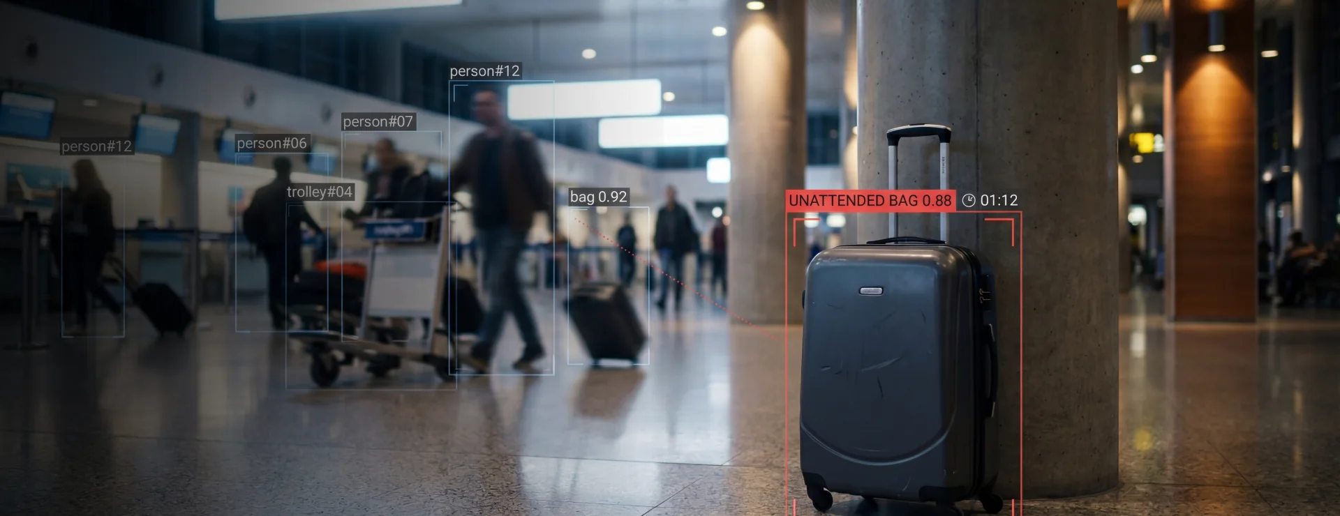
AI detection in a busy terminal flagging an unattended bag

See an incident where it happens

AI on every camera tracks people, bags and vehicles in busy public spaces and flags what needs attention, such as an unattended bag, a crowd building or a fire starting. Each alert is placed in the 3D model, so operators look around the scene live from a 360° view and send the right response.
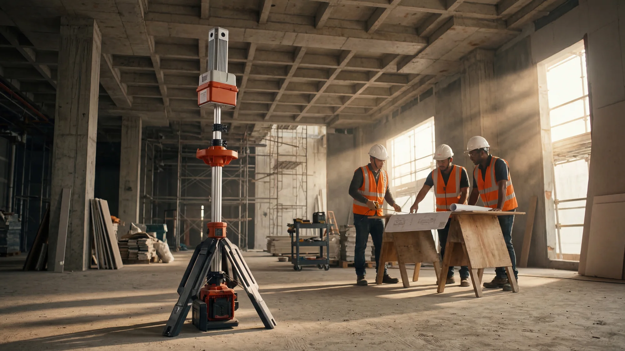
Polytron 360° tripod camera on a construction floor while workers review plans

Know what changed on site, every day

360° tripod cameras run 24/7 and move as the site grows, while weekly satellite imagery measures progress across the site and precinct. Both feed one model, so progress is compared to plan and changes are flagged automatically. HSE and PPE violations are seen and reported live.
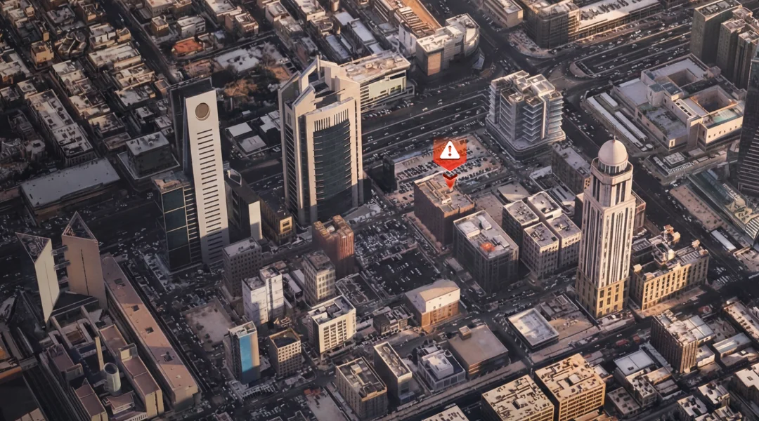
AI-built 3D model of a city centre with an alert on one building

Plan and run whole precincts

City-scale 3D models built from satellite imagery bring buildings, streets and public spaces into one view. Plan developments in context, then run the precinct with live video, sensors and access control placed in the model.
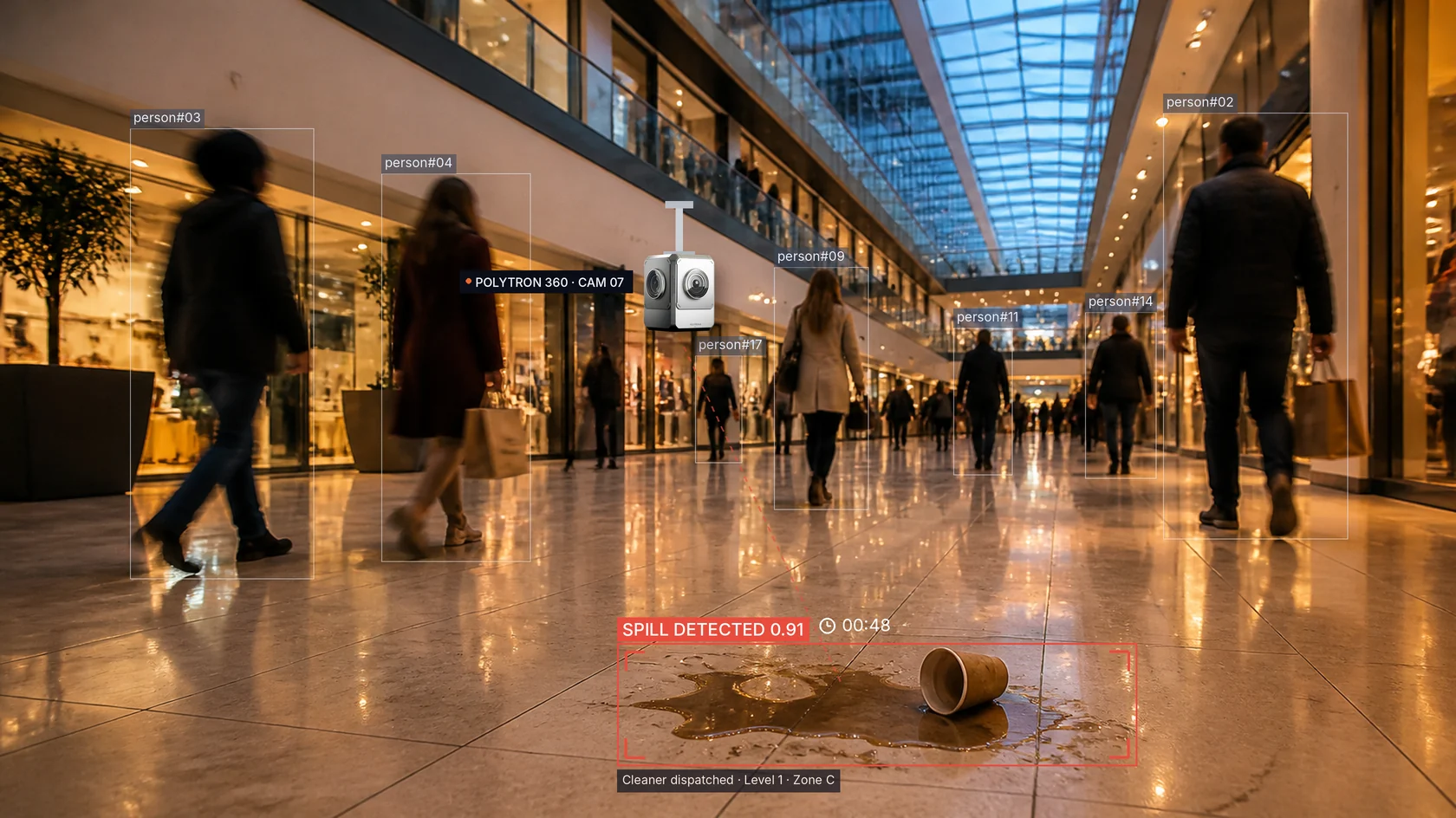
Polytron 360° camera in a shopping centre detecting a drink spill on the floor and dispatching a cleaner

One view of the whole centre

Polytron cameras watch every concourse and flag hazards like a spill the moment it happens, then dispatch a cleaner to the exact spot. Security, operations and centre management share one live view of every level.
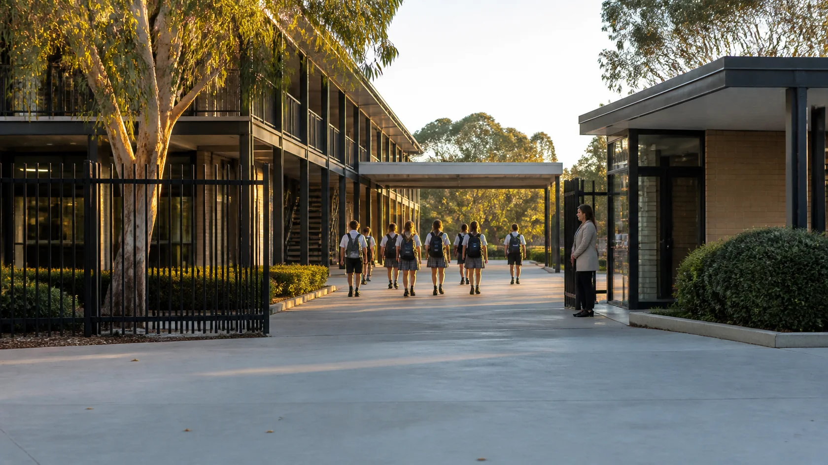
School campus courtyard in the afternoon with students and a teacher on duty

Safer campuses, every day

AI on every camera picks up the behaviour that matters, such as fights, bullying, loitering at the fence line or someone entering who shouldn't. Staff are alerted to the exact location, helping schools meet their duty of care. In an emergency, lockdowns and evacuations are managed from one live view, so every student is accounted for.
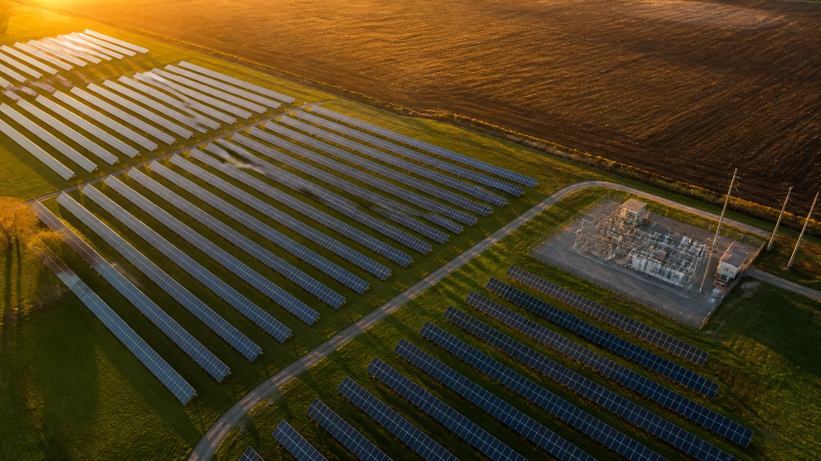
Aerial view of a solar farm with its substation

Protect and run critical infrastructure

Solar farms, substations, water and other utility sites are large, remote and hard to patrol. 360° cameras, sensors and access control feed one model, so intrusions, faults and fire risk are seen at their exact location and teams respond before an outage.
The technology

Three parts, working as one

Panoptec combines proven partner technology with our own integration platform, delivered and supported in Australia.

AI-built 3D model of a city centre with an alert located on one building
Digital twin · Vizzio

City-scale 3D models, built by AI

Vizzio's modelling engine builds dimensionally accurate, photorealistic 3D models from satellite imagery, from a single building up to a whole city.

Source
Satellite imagery + AI
Scale
Building to city
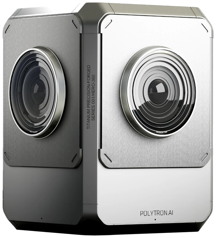
Polytron 360° AI camera
Cameras · Polytron

360° AI cameras

Polytron's 360° cameras stitch four sensors into one panoramic view and run analytics on the camera itself, so events are detected at the edge.

Coverage
360° per camera
Resolution
Up to 8K
Analytics
On-device AI
Integration · Panoptec

One operational view

Our integration layer brings access control, IoT sensors and existing video systems into the twin, so every event appears where it happens.

Sources
Any system with an API
Hosting
Microsoft Azure
The Panoptec platform

Every system, one picture of the site

Access control, cameras, sensors and building systems usually report to separate screens. Panoptec connects them through their APIs and places every event where it happened, in the digital twin.

ACS
Access control
Door 3B forced
VMS
Video
Loitering detected
IoT
Sensors
Smoke · 0.4 obs/m
BMS
Building systems
Chiller 2 fault
API
Any system with an API
Your data
Hosted on Microsoft Azure
Control centre
Live
08:42:10
Door 3B forced
L2 · North car park
08:41:52
Loitering detected
L1 · Laneway C
08:40:07
Smoke reading rising
L3 · Plant room
08:38:31
Chiller 2 fault
Roof · East
4 events · 4 locations
Open in 3D →
01
Connect each system once, through its API
02
Every event is given a place in the twin
03
Operators act from one view of the whole site
Who it's for

Built for large, busy sites

Anywhere many people, systems and spaces need to be understood at once.

Retail

Shopping centres

Malls, car parks and back-of-house in one model, shared by security and centre management.

Venues

Stadiums and events

Crowd density, entry flow and unattended items, seen across the whole venue as it fills and empties.

Transport

Stations and transport hubs

Virtual patrols and wayfinding across platforms, concourses and interchanges.

Commercial

Office and mixed-use

Tenancy access, building systems and security brought together for multi-tenant buildings.

Public

Precincts and public spaces

The spaces between buildings, where crowds move and incidents happen.

Construction

Construction sites

Perimeter breaches and PPE compliance monitored from fast-to-deploy 360° cameras.

Privacy

Designed for Australian privacy law

Spatial intelligence works with location and movement, not identity. We design every deployment around the Privacy Act and current OAIC guidance on surveillance and facial recognition.

No facial recognition by default
Privacy impact assessment as part of every pilot
Data held in Australian Azure regions
Clear retention and access controls
Technology partners

Proven technology, local delivery

We work with specialist partners and deliver, integrate and support the solution in Australia.

VIZZIO

Singapore developer of AI-built 3D digital twins, from single facilities to whole cities.

POLYTRON

360° AI cameras and the POLYTRON ONE video platform, with live video mapped into 3D.

Contact

Start with a pilot on one site.

Tell us about your property and what you need to see. We'll scope a pilot around it.